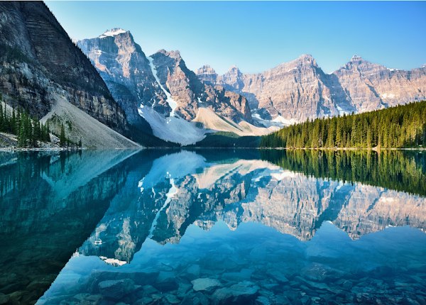
Illustrative mountain landscape; location not verified
Explore Trails

Illustrative stock landscape; not a verified trail photograph.

Trail Map & Route Guides

Compare 80 trail, viewpoint and lake listings around Banff and nearby parks. Start with a route description, then check its actual season, access and official report.

Planning information, not current trail status. Difficulty and season filters do not establish winter suitability, an open route or a prepared surface. Parking and crowds are not measured here.

Check official conditions and closures, the winter planning guide and the route's official map before travelling.
80 listings
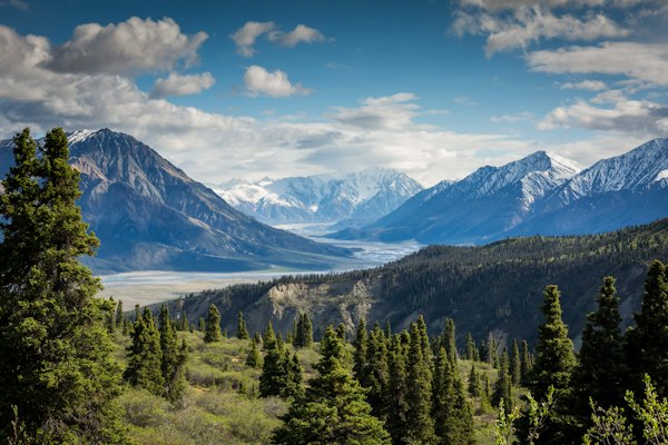
Illustrative outdoor stock photograph; not verified as this route

Illustrative stock photo

easy trail

Fenland Trail

A short natural-surface forest loop beside wetland on the edge of Banff townsite....
📏 1.9 km loop ⬆️ 20 m (loop profile) ⏱️ About 40 min loop estimate
Illustrative outdoor stock photograph; not verified as this route

Illustrative stock photo

easy trail

Marsh Trail (Cave and Basin)

A wetland trail from Cave and Basin beside the Bow River, with an uneven natural surface....

📏 1.5 km one way (3 km return) ⬆️ 15 m one way ⏱️ About 1 hr return
Illustrative outdoor stock photograph; not verified as this route

Illustrative stock photo

easy trail

Spray River East

The east-bank Spray River route to the upstream bridge, with a separate approach from Bow Falls....

📏 5.6 km one way to Spray River bridge ⬆️ 145 m one way ⏱️ 3–4 hr estimated return
Illustrative outdoor stock photograph; not verified as this route

Illustrative stock photo

easy trail

Spray River West

A mostly gravel valley route from the Banff Springs end of town to the Spray River bridge....

📏 5.7 km one way to Spray River bridge ⬆️ 130 m one way ⏱️ 3–4 hr estimated return
Illustrative outdoor stock photograph; not verified as this route

Illustrative stock photo

easy trail

Tunnel Campground Loop

A forest loop through the Tunnel Mountain campground area with several possible access points....
📏 6.3 km loop ⬆️ 110 m (loop profile) ⏱️ About 1.5 hr loop estimate
Illustrative outdoor stock photograph; not verified as this route

Illustrative stock photo

easy trail

Stewart Canyon (Lake Minnewanka)

A lakeside approach to Stewart Canyon that ends well before the long Aylmer routes....

📏 1.6 km one way to Stewart Canyon ⬆️ 30 m one way ⏱️ About 1 hr estimated return
Illustrative outdoor stock photograph; not verified as this route

Illustrative stock photo

easy trail

Johnson Lake

A lake circuit with natural paths, roots, steps and narrow shoreline sections....

📏 2.9 km loop ⬆️ 90 m (loop profile) ⏱️ About 1 hr loop estimate
Illustrative outdoor stock photograph; not verified as this route

Illustrative stock photo

easy trail

Sunshine Meadows

An alpine trail network reached through Sunshine’s seasonal sightseeing operation, with routes crossing the park boundar...

📏 10.3 km of trails (network, not one loop) ⬆️ 580 m in detailed network profile ⏱️ 4–5 hr network overview estimate
Illustrative outdoor stock photograph; not verified as this route

Illustrative stock photo

easy trail

Johnston Canyon Lower Falls

A narrow paved canyon path and catwalks to the Lower Falls viewpoint, subject to current access restrictions....

📏 1.1 km one way (2.2 km return) ⬆️ 85 m one way ⏱️ About 1 hr return
Illustrative outdoor stock photograph; not verified as this route

Illustrative stock photo

easy trail

Johnston Canyon Upper Falls

The longer Johnston Canyon outing to the Upper Falls, with more climbing and the same access checks as the Lower Falls....

📏 2.4 km one way (4.8 km return) ⬆️ 215 m one way ⏱️ About 2 hrs return
Illustrative outdoor stock photograph; not verified as this route

Illustrative stock photo

easy trail

Silverton Falls

A short waterfall branch from the Rockbound Lake approach, ending on a narrow natural path....
📏 0.9 km one way ⬆️ 85 m one way ⏱️ About 40 min estimated return
Illustrative outdoor stock photograph; not verified as this route

Illustrative stock photo

easy trail

Boom Lake

A forest approach to Boom Lake on Highway 93 South within Banff National Park, Alberta....

📏 5.1 km one way ⬆️ 180 m one way ⏱️ 3–4 hr estimated return
Illustrative outdoor stock photograph; not verified as this route

Illustrative stock photo

easy trail

Vista Lake

The short descending first section of the Arnica Lake route, with a climb back to the road....

📏 1.4 km one way to Vista Lake ⬆️ Not stated in current detailed profile ⏱️ About 1.5 hr estimated return
Illustrative outdoor stock photograph; not verified as this route

Illustrative stock photo

moderate trail

Sundance Canyon

A paved approach followed by a steeper hiking-only canyon loop, with a longer return than the loop length suggests....

📏 3.7 km one-way approach + 2.1 km canyon loop ⬆️ 190 m in route profile ⏱️ About 3 hr estimated full return
Illustrative outdoor stock photograph; not verified as this route

Illustrative stock photo

moderate trail

Ink Pots

Extend past Johnston Canyon Upper Falls to vivid cold-water mineral springs in an open meadow....
📏 5.5 km one way (11 km return) ⬆️ 425 m one way ⏱️ About 4 hrs return
Illustrative outdoor stock photograph; not verified as this route

Illustrative stock photo

moderate trail

Sulphur Mountain

A sustained uphill hiking route to the gondola’s upper area, with a separate boardwalk continuation....

📏 4.8 km one way to gondola top; +0.5 km to Sanson Peak ⬆️ 655 m one way to upper area ⏱️ About 4 hr estimated return (main trail)
Illustrative outdoor stock photograph; not verified as this route

Illustrative stock photo

moderate trail

Tunnel Mountain Summit

A town-area summit hike with switchbacks, roots and rock, distinct from the campground loop....
📏 2.3 km one way (published summit profile) ⬆️ 275 m one way ⏱️ About 2 hr estimated return
Illustrative outdoor stock photograph; not verified as this route

Illustrative stock photo

moderate trail

Surprise Corner to Hoodoos

A natural trail between two separate viewpoints, with ups and downs below the cliffs....

📏 4.4 km one way ⬆️ 115 m one way ⏱️ About 3 hr estimated return
Illustrative outdoor stock photograph; not verified as this route

Illustrative stock photo

moderate trail

Upper Stoney

A narrow forest loop in the Norquay area with roots, rocks and an old ski-run connection....
📏 4.4 km loop ⬆️ 210 m (loop profile) ⏱️ About 1.5 hr loop estimate
Illustrative outdoor stock photograph; not verified as this route

Illustrative stock photo

moderate trail

Cascade Amphitheatre

A forest approach to the Cascade Amphitheatre meadow, ending before Cascade Mountain’s scramble route....

📏 6.8 km one way ⬆️ 740 m one way ⏱️ About 6 hr estimated return
Illustrative outdoor stock photograph; not verified as this route

Illustrative stock photo

moderate trail

C-Level Cirque

An uphill forest route past traces of Bankhead’s mining history to the cirque....

📏 3.8 km one way ⬆️ 440 m one way ⏱️ About 3 hr estimated return
Illustrative outdoor stock photograph; not verified as this route

Illustrative stock photo

moderate trail

Healy Pass

A long valley-to-pass hike beginning at Sunshine’s base area, separate from the lift-served Meadows network....
📏 8.8 km one way ⬆️ 650 m one way ⏱️ 6–7 hr estimated return
Illustrative outdoor stock photograph; not verified as this route

Illustrative stock photo

moderate trail

Bourgeau Lake

A steady forest climb to Bourgeau Lake, with Harvey Pass a separate longer endpoint....
📏 6.7 km one way to Bourgeau Lake ⬆️ 730 m one way ⏱️ About 6 hr estimated return
Illustrative outdoor stock photograph; not verified as this route

Illustrative stock photo

moderate trail

Harvey Pass

The longer Bourgeau corridor hike continuing above the lake to Harvey Pass....

📏 8.9 km one way from Bourgeau trailhead ⬆️ 1,010 m one way ⏱️ 6–7 hr estimated return
Illustrative outdoor stock photograph; not verified as this route

Illustrative stock photo

moderate trail

Rockbound Lake

A long climb through forest and past Tower Lake to the Rockbound basin....

📏 8.5 km one way to Rockbound Lake ⬆️ 765 m one way ⏱️ 6–7 hr estimated return
Illustrative outdoor stock photograph; not verified as this route

Illustrative stock photo

moderate trail

Arnica Lake

A route that descends first to Vista Lake before climbing through forest and larches to Arnica Lake....

📏 4.6 km one way to Arnica Lake ⬆️ 580 m one way ⏱️ About 5 hr estimated return
Illustrative outdoor stock photograph; not verified as this route

Illustrative stock photo

moderate trail

Lower Twin Lake via Arnica

The full Arnica corridor to Lower Twin Lake, passing Vista, Arnica and Upper Twin along the way....

📏 7.4 km one way to Lower Twin Lake via Arnica ⬆️ 700 m one way ⏱️ 6–7 hr estimated return
Illustrative outdoor stock photograph; not verified as this route

Illustrative stock photo

challenging trail

Aylmer Lookout

A long Minnewanka shoreline approach followed by a climb to the former fire-lookout site....

📏 11.6 km one way from Minnewanka day-use area ⬆️ 770 m one way ⏱️ 7–8 hr estimated return
Illustrative outdoor stock photograph; not verified as this route

Illustrative stock photo

challenging trail

Aylmer Pass

A long shoreline-and-mountain hike to Aylmer Pass, distinct from the lookout branch....

📏 13.1 km one way from Minnewanka day-use area ⬆️ 970 m one way ⏱️ 8–9 hr estimated return
Illustrative outdoor stock photograph; not verified as this route

Illustrative stock photo

challenging trail

Cory Pass Loop

A steep, rocky pass circuit returning via Gargoyle Valley and Edith Pass, with route finding required....

📏 11.7 km loop (detailed Parks Canada profile) ⬆️ 930 m (loop profile) ⏱️ About 6 hr loop estimate
Illustrative outdoor stock photograph; not verified as this route

Illustrative stock photo

easy trail

Lake Louise Lakeshore

A designated shoreline route from Lake Louise lakeshore, distinct from travelling on the lake ice....

📏 2.3 km one way (4.6 km return) ⬆️ 175 m (current summer guide) ⏱️ About 1 hr return; conditions vary
Illustrative outdoor stock photograph; not verified as this route

Illustrative stock photo

easy viewpoint

Fairview Lookout

A short but steep lakeshore-side climb to a lookout, distinct from Fairview Mountain....

📏 1.2 km one way ⬆️ 100 m one way ⏱️ About 45 min estimated return
Illustrative outdoor stock photograph; not verified as this route

Illustrative stock photo

easy trail

Bow River (Lake Louise)

A village-area riverside route with a choice of sections and a seasonal west-bank restriction....

📏 Up to 5.7 km one way; choose a section ⬆️ 25 m in published profile ⏱️ About 2 hr published return estimate; varies with section
Illustrative outdoor stock photograph; not verified as this route

Illustrative stock photo

easy viewpoint

Rockpile

A short scramble up a glacial debris mound to the iconic Valley of the Ten Peaks viewpoint at Moraine Lake....

📏 0.7 km loop ⬆️ 35 m ⏱️ 30 min
Illustrative outdoor stock photograph; not verified as this route

Illustrative stock photo

easy trail

Moraine Lake Lakeshore

A designated shoreline out-and-back reached by authorized seasonal transport, rather than a circuit of the whole lake....

📏 1.3 km one way ⬆️ Minimal (official profile; not a measured zero) ⏱️ About 45 min estimated return
Illustrative outdoor stock photograph; not verified as this route

Illustrative stock photo

easy lake

Consolation Lakes

A hike from Moraine Lake to the first Consolation Lake; higher lakes and boulder extensions are outside this profile....

📏 2.9 km one way to first Consolation Lake ⬆️ 135 m one way ⏱️ About 2 hr estimated return
Illustrative outdoor stock photograph; not verified as this route

Illustrative stock photo

moderate trail

Lake Agnes

A summer mountain hike from Lake Louise to Lake Agnes and a seasonal tea house....

📏 3.9 km one way (7.8 km return) ⬆️ 495 m one way ⏱️ About 2.5–3 hrs return
Illustrative outdoor stock photograph; not verified as this route

Illustrative stock photo

moderate trail

Plain of Six Glaciers

A summer hike beyond Lake Louise into a glacial valley, with a seasonal tea-house option....

📏 5.9 km one way (11.8 km return) ⬆️ 595 m one way ⏱️ About 4 hrs return
Illustrative outdoor stock photograph; not verified as this route

Illustrative stock photo

moderate trail

Tramline

A walking or cycling connection between the Lake Louise village area and lakeshore, using the current lower alignment....

📏 4.3 km one way (current summer profile) ⬆️ 220 m in village-to-lakeshore direction ⏱️ About 2.5 hr estimated return
Illustrative outdoor stock photograph; not verified as this route

Illustrative stock photo

moderate lake

Lake Annette (Paradise Valley)

A forest approach in Banff’s Paradise Valley to the lake beneath Mount Temple, not the Lake Annette in Jasper....

📏 5.7 km one way ⬆️ 345 m one way ⏱️ About 4 hr estimated return
Illustrative outdoor stock photograph; not verified as this route

Illustrative stock photo

moderate lake

Eiffel Lake

A high valley-side route branching from the Larch Valley approach towards views above Eiffel Lake....

📏 5.7 km one way ⬆️ 560 m one way ⏱️ 4–5 hr estimated return
Illustrative outdoor stock photograph; not verified as this route

Illustrative stock photo

moderate trail

Larch Valley / Minnestimma Lakes

A climb from Moraine Lake to the Larch Valley and Minnestimma Lakes area, without automatically continuing to Sentinel P...

📏 4.5 km one way ⬆️ 570 m one way ⏱️ 3.5–4 hr estimated return
Illustrative outdoor stock photograph; not verified as this route

Illustrative stock photo

challenging trail

Saddleback Pass

A sustained climb from Lake Louise to Saddleback Pass, with a different endpoint from Fairview Mountain....

📏 3.6 km one way ⬆️ 600 m one way ⏱️ 3–4 hr estimated return
Illustrative outdoor stock photograph; not verified as this route

Illustrative stock photo

challenging trail

Fairview Mountain

A substantial summit hike above Lake Louise, distinct from the short Fairview Lookout trail....

📏 5 km one way ⬆️ 990 m one way ⏱️ 5–6 hr estimated return
Illustrative outdoor stock photograph; not verified as this route

Illustrative stock photo

challenging trail

Sheol / Paradise Connector

A mountain connector between Saddleback Pass and Paradise Valley, not a complete 3.9 km trailhead-to-trailhead outing....

📏 3.9 km one way (connector only; approaches excluded) ⬆️ 85 m from Saddleback towards Paradise ⏱️ 1–2 hr estimated one way on connector only
Illustrative outdoor stock photograph; not verified as this route

Illustrative stock photo

challenging trail

Paradise Valley and Giant Steps

A long Paradise Valley outing to the Giant Steps area, with Lake Annette a separate earlier endpoint....

📏 9.8 km one way ⬆️ 595 m one way ⏱️ 7–8 hr estimated return
Illustrative outdoor stock photograph; not verified as this route

Illustrative stock photo

challenging trail

Sentinel Pass from Paradise Valley

The long Paradise Valley approach to Sentinel Pass, with steep rocky route finding near the pass....

📏 14.2 km one way (Parks Canada profile) ⬆️ 1,160 m one way ⏱️ 9–10 hr published return estimate
Illustrative outdoor stock photograph; not verified as this route

Illustrative stock photo

challenging trail

Sentinel Pass via Larch Valley

The Moraine Lake approach through Larch Valley and up steep switchbacks to Sentinel Pass....

📏 5.6 km one way ⬆️ 750 m one way ⏱️ 4.5–5.5 hr estimated return
Illustrative outdoor stock photograph; not verified as this route

Illustrative stock photo

challenging trail

Wenkchemna Pass

A long pass objective beyond the Eiffel Lake area, with a full return to Moraine Lake....

📏 9.6 km one way ⬆️ 1,015 m one way ⏱️ 7–8 hr estimated return
Illustrative outdoor stock photograph; not verified as this route

Illustrative stock photo

challenging lake

Hidden Lake

A long Fish Creek approach into the Boulder Pass area and on to Hidden Lake....

📏 8.5 km one way ⬆️ 700 m one way ⏱️ 6–7 hr estimated return
Illustrative outdoor stock photograph; not verified as this route

Illustrative stock photo

challenging trail

Deception Pass

A long day hike from Fish Creek via Boulder Pass and Ptarmigan Lake towards Deception Pass....

📏 11.5 km one way ⬆️ 835 m one way ⏱️ 8–9 hr estimated return
Illustrative outdoor stock photograph; not verified as this route

Illustrative stock photo

moderate viewpoint

Castle Lookout

A sustained climb to the former Castle fire-lookout location, not Castle Mountain’s summit....

📏 3.7 km one way ⬆️ 520 m one way ⏱️ 3–4 hr estimated return
Illustrative outdoor stock photograph; not verified as this route

Illustrative stock photo

moderate trail

Stanley Glacier

A Kootenay National Park mountain hike from Highway 93 South to an alpine basin below Stanley Glacier....

📏 4.9 km one way (9.8 km return) ⬆️ 405 m one way ⏱️ About 3 hrs return (Parks guide)
Illustrative outdoor stock photograph; not verified as this route

Illustrative stock photo

moderate lake

Taylor Lake

A forest climb to Taylor Lake’s subalpine basin, with snow sometimes lingering into the hiking season....

📏 6.3 km one way (official area table basis) ⬆️ 585 m one way ⏱️ 4–5 hr estimated return
Illustrative outdoor stock photograph; not verified as this route

Illustrative stock photo

easy viewpoint

Peyto Lake Viewpoint

A short uphill route to Peyto Lake Lookout, with a separate barrier-free approach from the upper parking area....

📏 0.6 km one way (main lookout approach) ⬆️ 30 m ⏱️ About 30 min return
Illustrative outdoor stock photograph; not verified as this route

Illustrative stock photo

easy viewpoint

Bow Summit Viewpoint

A longer route beyond the main Peyto Lake lookout, following an old fire road towards the Bow Summit viewpoint....

📏 3 km one way ⬆️ 310 m one way ⏱️ About 2.5 hr estimated return
Illustrative outdoor stock photograph; not verified as this route

Illustrative stock photo

easy trail

Mistaya Canyon

A short descent from the Parkway parking area to the canyon footbridge, with an uphill return....

📏 0.6 km one way (detailed profile) ⬆️ 10 m one way ⏱️ About 30 min estimated return
Illustrative outdoor stock photograph; not verified as this route

Illustrative stock photo

moderate trail

Bow Glacier Falls

A scenic trail from Bow Lake to the waterfall at the toe of the Bow Glacier, source of the Bow River....

📏 3.8 km one way (7.6 km return) ⬆️ 95 m one way ⏱️ About 3 hrs return
Illustrative outdoor stock photograph; not verified as this route

Illustrative stock photo

moderate lake

Helen Lake

A climb into the alpine to Helen Lake, with Dolomite Pass a separate longer destination....

📏 5.9 km one way ⬆️ 530 m one way ⏱️ 4–5 hr estimated return
Illustrative outdoor stock photograph; not verified as this route

Illustrative stock photo

moderate lake

Cirque Lake

A forested Waterfowl-area route to Cirque Lake, with muddy ground noted in the official profile....

📏 4.6 km one way ⬆️ 210 m one way ⏱️ About 3 hr estimated return
Illustrative outdoor stock photograph; not verified as this route

Illustrative stock photo

moderate lake

Chephren Lake

A forest route from the Waterfowl area to Chephren Lake beneath the surrounding mountain walls....

📏 4.1 km one way ⬆️ 140 m one way ⏱️ About 3 hr estimated return
Illustrative outdoor stock photograph; not verified as this route

Illustrative stock photo

moderate trail

Nigel Pass

A long approach towards Nigel Pass in the boundary area between Banff and Jasper national parks....

📏 7.3 km one way ⬆️ 395 m one way ⏱️ 4–5 hr estimated return (detailed profile)
Illustrative outdoor stock photograph; not verified as this route

Illustrative stock photo

moderate trail

Parker Ridge

A switchback climb to a ridge viewpoint above the Saskatchewan Glacier valley....

📏 2.7 km one way ⬆️ 305 m one way ⏱️ About 2.5 hr estimated return
Illustrative outdoor stock photograph; not verified as this route

Illustrative stock photo

challenging trail

Molar Pass

A long route into alpine meadows at Molar Pass from the Mosquito Creek area....

📏 9.8 km one way ⬆️ 560 m one way ⏱️ 7–8 hr estimated return
Illustrative outdoor stock photograph; not verified as this route

Illustrative stock photo

challenging trail

North Molar Pass

The longer, higher pass choice branching from the Molar corridor into rocky alpine terrain....

📏 11.5 km one way ⬆️ 795 m one way ⏱️ 8–9 hr estimated return
Illustrative outdoor stock photograph; not verified as this route

Illustrative stock photo

challenging trail

Dolomite Pass

A longer continuation beyond Helen Lake to Dolomite Pass, with the lake approach included in its figures....

📏 8.9 km one way from Helen Lake trailhead ⬆️ 655 m one way ⏱️ 6–7 hr estimated return
Illustrative outdoor stock photograph; not verified as this route

Illustrative stock photo

challenging lake

Peyto Lake Trail (Shore)

An officially listed difficult summer trail descending from Peyto Lookout to the lake, separate from the short lookout w...

📏 1.3 km one way from Peyto Lookout ⬆️ 30 m one way ⏱️ About 2 hrs return; add lookout approach
Illustrative outdoor stock photograph; not verified as this route

Illustrative stock photo

challenging lake

Glacier Lake

A long rolling forest route to Glacier Lake, with outward descent to regain on the return....

📏 8.8 km one way ⬆️ 260 m one way ⏱️ 6–7 hr estimated return
Illustrative outdoor stock photograph; not verified as this route

Illustrative stock photo

challenging viewpoint

Sunset Lookout

A steep climb on the Sunset corridor to a former fire-lookout site, separate from Sunset Pass....

📏 4.5 km one way ⬆️ 615 m one way ⏱️ 3–4 hr estimated return
Illustrative outdoor stock photograph; not verified as this route

Illustrative stock photo

challenging trail

Sunset Pass

A long climb through forest to the meadow at Sunset Pass, with a full return to the Parkway....
📏 8.1 km one way ⬆️ 715 m one way ⏱️ 6–7 hr estimated return
Illustrative outdoor stock photograph; not verified as this route

Illustrative stock photo

moderate trail

Cascade Valley Cross-Country Ski Trail

A designated winter ski route from Lake Minnewanka Day-use Area, with distance chosen by turnaround....

📏 6.3 km one way to Cascade River bridge ⬆️ 135 m one way to bridge ⏱️ Depends on turnaround and ski conditions
Illustrative outdoor stock photograph; not verified as this route

Illustrative stock photo

moderate trail

Spray River West Cross-Country Ski

A winter ski outing on Spray River West, with the official bridge turnaround distinguished from a loop....

📏 5.6 km one way (11.2 km return) ⬆️ 105 m one way ⏱️ Depends on ski conditions and group pace
Illustrative outdoor stock photograph; not verified as this route

Illustrative stock photo

easy trail

Tunnel Mountain Winter Trails

A designated winter trail network in Tunnel Mountain Trailer Court Campground, with current grooming checked before use....

📏 8 km across all loops ⬆️ No elevation gain in official overview ⏱️ Depends on chosen loop and conditions
Illustrative outdoor stock photograph; not verified as this route

Illustrative stock photo

easy trail

Johnston Canyon Ice Walk

Winter planning for Johnston Canyon viewpoints, with current closures and footing checked before choosing a walk....

📏 Up to 4.8 km return to Upper Falls ⬆️ 215 m one way to Upper Falls ⏱️ Allow extra time for winter conditions
Illustrative outdoor stock photograph; not verified as this route

Illustrative stock photo

easy trail

Lake Louise Lakeshore Winter Walk

Winter planning for the designated Lake Louise shoreline route, without assuming access over lake ice....

📏 2.3 km one way (4.6 km return) ⬆️ 175 m (official winter guide) ⏱️ Allow time for actual winter conditions
Illustrative outdoor stock photograph; not verified as this route

Illustrative stock photo

easy trail

Marble Canyon Snowshoe

A canyon-rim winter visit in Kootenay National Park, subject to the current trail and bridge notices....

📏 0.9 km one way (1.8 km return) ⬆️ 65 m one way ⏱️ Depends on winter conditions
Illustrative outdoor stock photograph; not verified as this route

Illustrative stock photo

moderate trail

Ink Pots Winter Snowshoe

Winter planning for the longer Ink Pots outing, requiring its own current route and approach assessment....

📏 5.5 km one way on the listed summer approach ⬆️ 425 m (listed summer approach) ⏱️ Requires separate winter planning
Illustrative outdoor stock photograph; not verified as this route

Illustrative stock photo

moderate trail

Goat Creek Cross-Country Ski Trail

A point-to-point winter ski route between Goat Creek above Canmore and Spray River West near Banff....

📏 19 km one way ⬆️ 435 m in official profile; confirm direction ⏱️ A separate point-to-point plan is required
Illustrative outdoor stock photograph; not verified as this route

Illustrative stock photo

moderate trail

Healy Creek Cross-Country Ski Trail

A winter route between Healy Creek/Brewster Creek trailhead and Sundance Canyon junction....

📏 5.5 km one way between listed endpoints ⬆️ 95 m one way ⏱️ Depends on route and snow conditions
Illustrative outdoor stock photograph; not verified as this route

Illustrative stock photo

easy trail

Bow Falls Trail

A riverside walk from Banff’s Bow River Bridge towards Bow Falls, with a clifftop section closed in winter....

📏 1.2 km one way from Bow River Bridge ⬆️ Check official route map ⏱️ About 20–25 min one way (Town guide)